High-resolution
elevation data
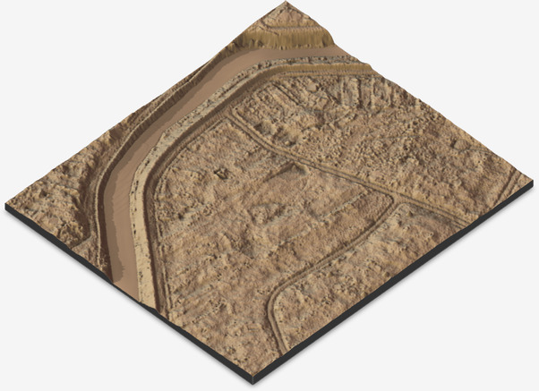
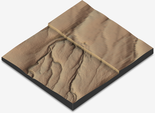
The GPXZ DEM seamlessly merges high quality elevation data, from global bathymetry to 50cm lidar.
Our API lets you make low-latency point queries, generate hires 2D geotiffs, and has a drop-in replacement for the Google Elevation API.
Get an API key →{
"result": {
"elevation": 67.224442,
"lat": 51.65,
"lon": -0.41,
"data_source": "england_1m_dtm",
"resolution": 1,
"capture_date_min": "2018-01-18",
"capture_date_max": "2023-03-15"
},
"status": "OK"
}Dataset
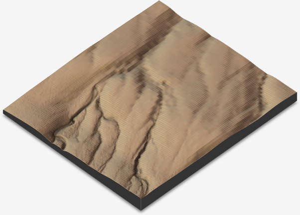
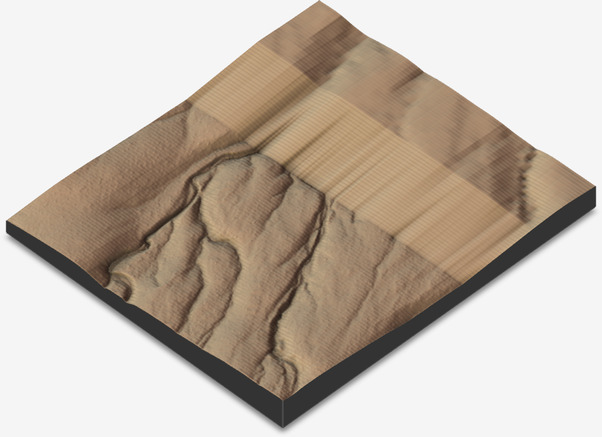
GPXZ uses high-resolution lidar data where available. Compared to satellite-based imagery, lidar is more accurate and captures finer details.
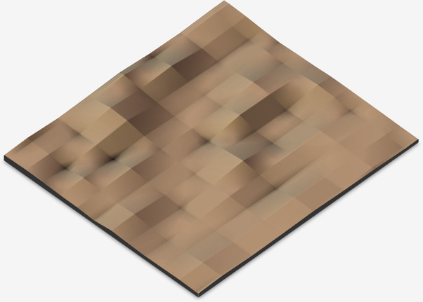
Where lidar is not available, base imagery from the 30m Copernicus dataset is used. Released in 2020, this dataset massively improves on large-scale datasets that came before.
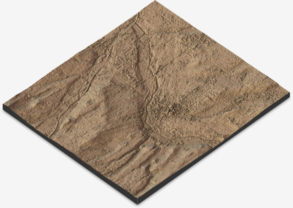
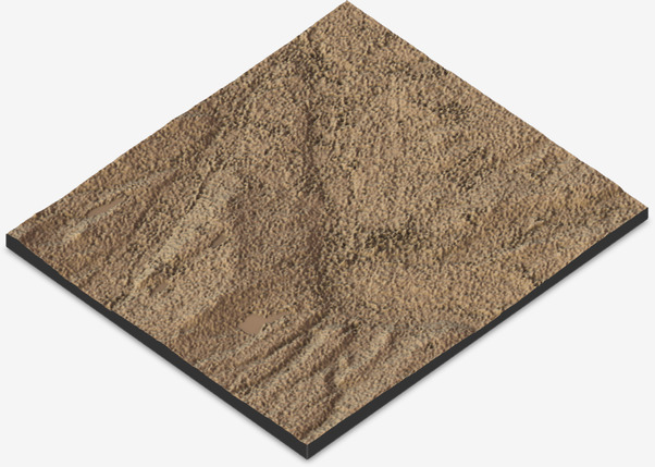
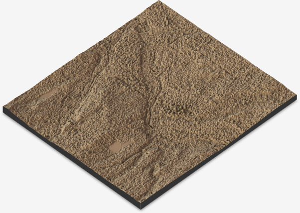
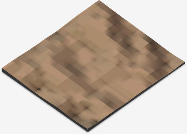
GPXZ uses a custom seamless merging algorithm to combine datasets. This approach avoids the cliffs and discontinuities created by simple overlay or linear methods, which interfere with hydrology and create discontinuities in elevation profiles.
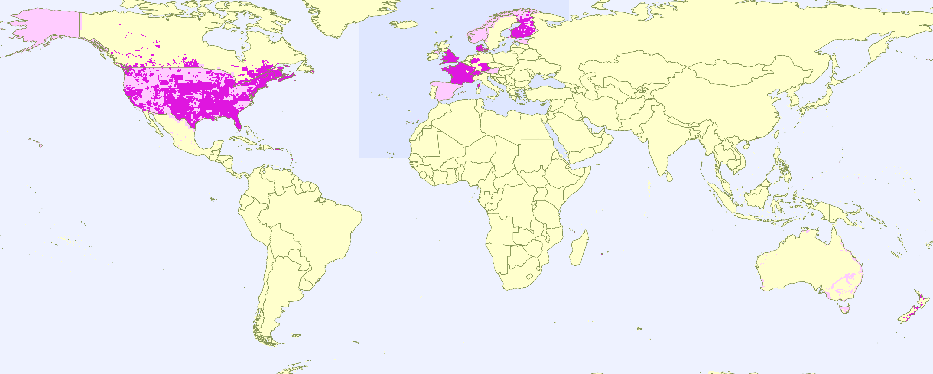
Coverage
The GPXZ dataset starts with a base of ocean depth from GEBCO 2023 and land elevation from Copernicus 30m. From there, hi-res open lidar datasets are added. Last updated October 2023.
Usage
You can query the elevation (in metres) of a single point by its latitude and longitude.
https://api.gpxz.io/v1/elevation/point?lat=67.1&lon=17.4
Multiple points can be queried together using pipe-separated lat,lon pairs.
https://api.gpxz.io/v1/elevation/points?latlons=-38.00,177.99|-38.27,177.57
Generate 2D raster extracts by providing a bounding box and resolution. A geotiff is returned.
https://api.gpxz.io/v1/elevation/hires-raster?res_m=2&bbox_left=22.3&bbox_right=22.4&bbox_bottom=37.58&bbox_top=37.6
Finally, GPXZ can be used to migrate from the Google Maps Elevation API. Just replace
https://maps.googleapis.com/maps/api/elevation/
with
https://api.gpxz.io/v1/elevation/gmaps-compat/
For example
https://api.gpxz.io/v1/elevation/gmaps-compat/json?locations=51.65,-0.41
All Google Maps parameters and query types are supported.
The docs page has full details of authentication, endpoints, request parameters, and response examples.
Features
Pricing
We charge a fixed monthly price for access. On paid plans, there are no overage charges and you won't be cut off for occasionally exceeding your quota.
- 100 requests per day
- 1 request per second
- Testing only
- No credit card required
- 2,500 requests per day
- 10 requests per second
- Commercial use
- Priority support
- 7,500 requests per day
- 25 requests per second
- Commercial use
- Priority support
- High limits
- Service contract
- Onboarding
- Enterprise support
Open source
GPXZ is built on the shoulders of open software and data, so it's important to us to give back to the community.
An open fork of our API server is available as Open Topo Data. Paid GPXZ API subscriptions support the development of this open software.
 Star
385
Star
385
We also write about the development of GPXZ on the blog. Recent posts have covered elevation data in Hong Kong and filling voids in elevation data using Python.